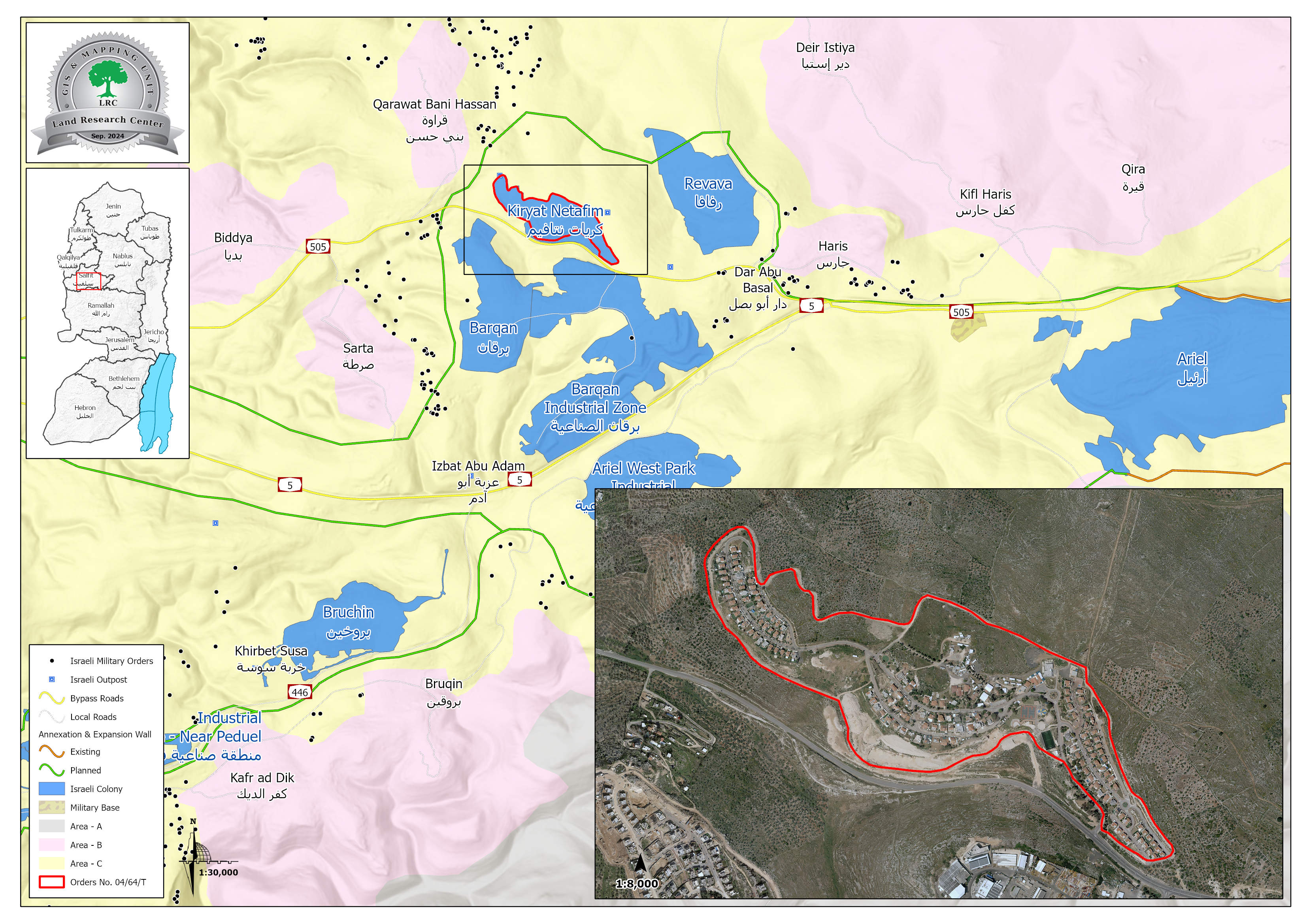
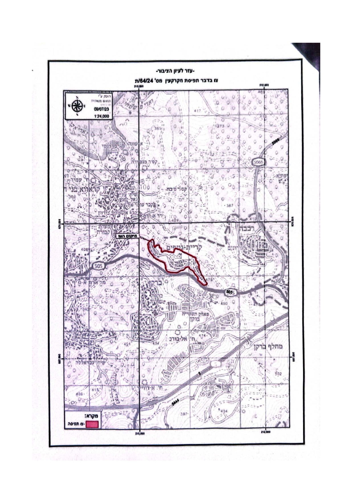
To expand the boundaries of the "Kiryat Netafim" settlement- The occupation issues an order to seize lands belonging to the villages of Haris and Qarawat Bani Hassan in the Salfit Governorate
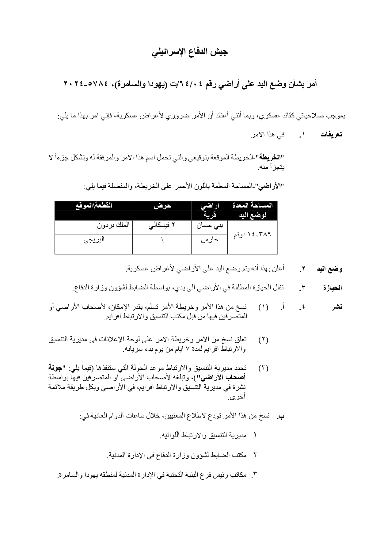
Violation: An order to seize 14.389 dunums.
Location: The village of Haris and the town of Qarawat Bani Hassan, Salfit Governorate.
Date of Violation: 17/07/2024.
Perpetrator: Commander of the occupation forces in the West Bank.
Affected Party: Farmers in the area
Description:
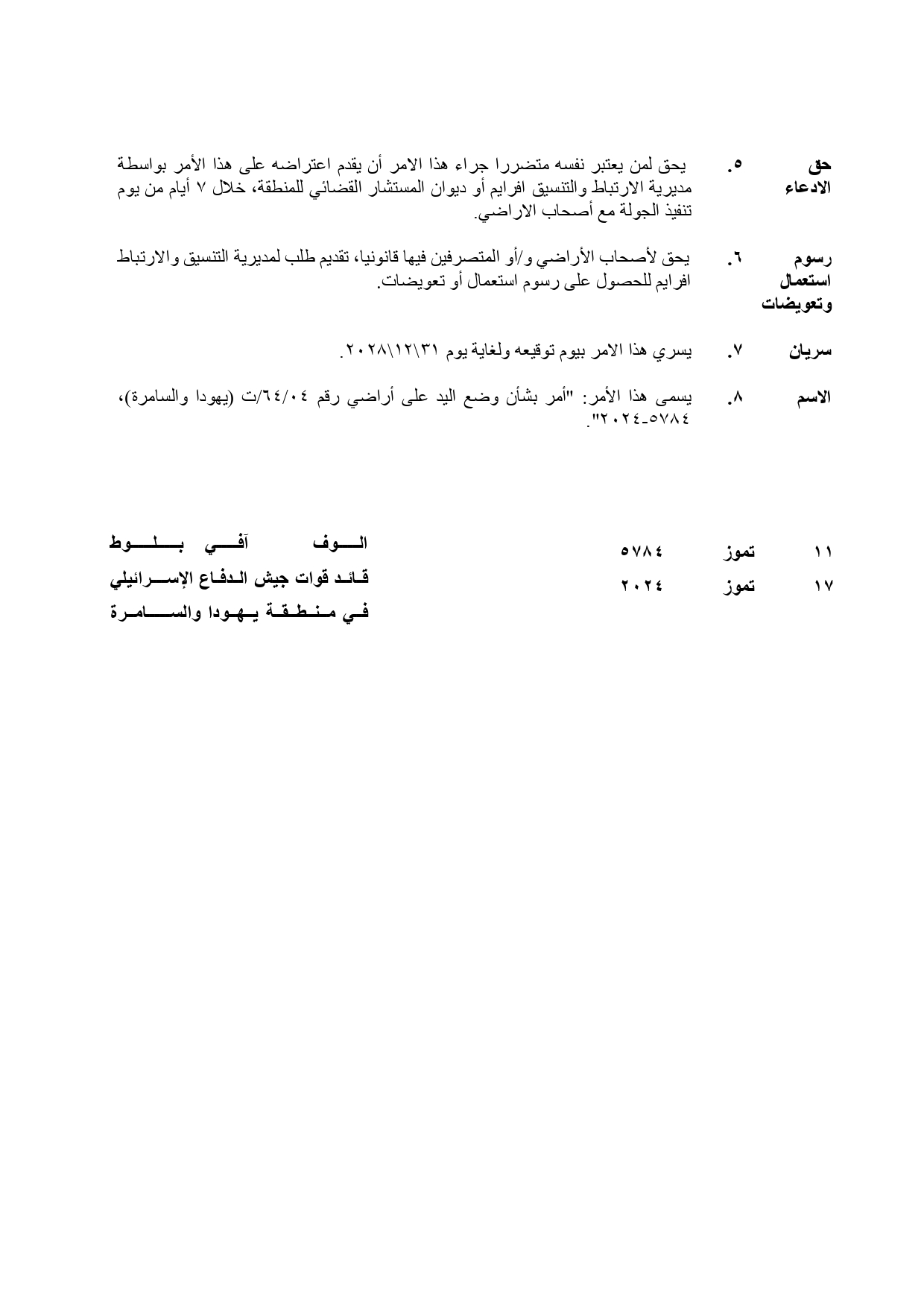
In July, the so-called Israeli occupation army commander in the West Bank, "Alof Avi Balot", issued a military order to seize (14.3 dunums) of land from the village of Haris and the town of Qarawa Bani Hassan under the pretext of "security reasons."
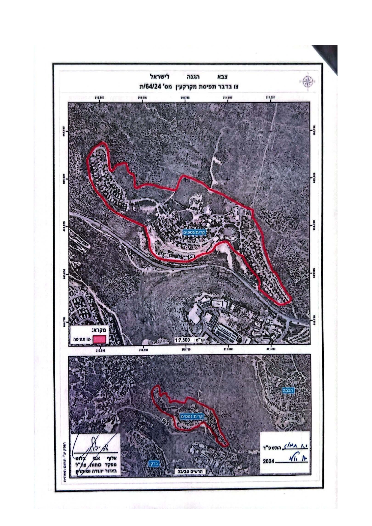
According to the military notification titled Land Seizure Order No. (04/64/T) accompanied by a map and aerial photograph showing the seized lands, the occupation identified the locations of the confiscated lands as follows:
- Town of Qarawat Bani Hassan: Within Basin No. 2, in the "Malik Bardoun" area.
- Village of Haris: In the "Al-Bureji" area.
The attached map indicates that the Israeli occupation plans to build a separation fence around the settlement of "Kiryat Netafim," which is built on the lands of the two villages. This aims to create a buffer zone around the settlement, paving the way for the confiscation of more agricultural lands in its vicinity. It also facilitates the closure of additional areas around the settlement under the pretext of the presence of this fence.
The Kiryat Netafim settlement was established in the early 1980s when settlers confiscated vast areas of land from Qarawat Bani Hassan to expand settlement activities near a Roman-era water spring called "Notef." The settlement's name is derived from this spring, reflecting the deep historical roots of Palestinians in the land. The occupation did not stop at stealing the name but also the land, systematically Judaizing it and altering its character and landmarks. This represents an attempt to erase Palestinian history after seizing their land.
Moreover, the settlement significantly contributes to polluting the Palestinian environment by discharging untreated wastewater into agricultural fields over a distance exceeding two kilometers. This wastewater causes the spread of diseases, and despite numerous complaints, the occupation authorities have not taken any steps to address the worsening problem, which continues to harm local communities and spread various illnesses.
Haris Village [1]:
Haris village is located west of Salfit city, approximately 6 kilometers away. The total area of the village is about 8,450 dunums, with a built-up area of approximately 320 dunums. It is bordered by Deir Istiya to the north, Kifl Haris to the east, Bruqin and Kafr ad-Dik to the southwest and Qarawat Bani Hassan to the west.
The village has a population of approximately 4,137 residents, according to the 2017 statistics from the Palestinian Central Bureau of Statistics. The residents belong to the following families: Abu Atta, Dawood, Salameh, Sultan, Shahada, Wasouf, Awad, Fazaa, Qassem, and Kleib.
Haris village stands as a living testimony to the bitterness and brutality of the Israeli occupation. A colonial road, Route 505, was constructed on its fertile agricultural lands. The road stretches 4 kilometers and connects the Green Line to the heart of the occupied West Bank.
Qarawat Bani Hassan Town [2]:
The town of Qarawat Bani Hassan is located 12 kilometers northwest of Salfit city. It is bordered by Deir Istiya to the north, Bidya to the west, Deir Istiya and Haris to the east and Sarta to the south.
The population of the town is approximately 5,513 residents as of 2017.
The total area of the town is 9,443 dunums, of which 565 dunums are designated as the built-up area of the village.
Israeli settlements have confiscated 324 dunums of the town's land.
Bypass roads have seized 129 dunums, particularly for Route 505.
Land Classification under the Oslo Accords:
- 849 dunums classified as Area B.
- 8,594 dunums classified as Area C.
Land Confiscation Violates International Laws:
Israel's actions in the occupied Palestinian territories constitute a violation of the rights of the Palestinian people and their lands, as well as a breach of international laws and norms. Below are the key provisions in international laws and treaties that prohibit Israeli settlement activities in Palestinian territories and protect civilian and public property in occupied lands, along with relevant United Nations resolutions:
Lahay Regulations (1907):
- Article 46: The occupying power is prohibited from confiscating private property.
- Article 55: The occupying power acts as an administrator of the lands in the occupied country and must treat the properties as private property.
Fourth Geneva Convention (1949):
- Article 49: The occupying power is prohibited from transferring its own population to the territories it occupies or undertaking any measures that lead to demographic changes.
- Article 53: The occupying forces are prohibited from destroying personal, collective, state, or authority-owned properties in the occupied country.
- Article 147: The destruction and seizure of property, not justified by military necessity and carried out unlawfully and wantonly, constitute grave breaches of the Convention.
مشروع: حماية الحقوق البيئية الفلسطينية في مناطق "ج" SPERAC IV - FCDO
Disclaimer: The views and opinions expressed in this report are those of Land Research Center and do not necessarily reflect the views or positions of the project donor; the Norwegian Refugee Council.
إخلاء المسؤولية: الآراء ووجهات النظر الواردة في هذا التقرير هي آراء ووجهات نظر مركز أبحاث الأراضي ولا تعكس بالضرورة وجهات نظر أو مواقف الجهة المانحة للمشروع؛ المجلس النرويجي. للاجئين
